Maps of the Caribbean
The Caribbean is a group of about 7,000 islands, separating the Gulf of Mexico and the Caribbean Sea, to the west and south, from the Atlantic Ocean, to the east and north. They are part of the larger group called the West Indies , which includes the Greater Antilles, the Lesser Antilles, Bahamas , as well as Turks and Caicos. Geographically, the Caribbean islands are subregion of North America.
On WhyGo Caribbean, we talk about all islands part of the West Indies.
Map of the Caribbean
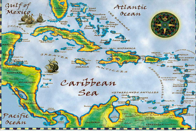
Of course, this is a map for general purposes only. When visiting any of the islands (or archipelagos) in the area, you should get a detailed map of the area you are visiting.
Should you visit Bahamas , you can get this map which includes insets with street maps of Nassau and Freeport. If you go to Puerto Rico , this adventure map is a good choice.
Remember that if you plan to do any driving , you should download a recent map of the area or get a recent map once you get to the island.